
Overview
Download functions such as gisco_get_countries(), gisco_get_nuts() and gisco_get_lau() retrieve GISCO datasets for local analysis. They return sf objects that you can filter, join and map.
Use the GISCO APIs to look up features or addresses using coordinates, an address or an identifier. giscoR provides two sets of API functions.
-
gisco_id_api_*()functions query the GISCO ID service API. -
gisco_address_api_*()functions query the GISCO Address API.
These functions use live GISCO services. Results can change as services and source datasets are updated. Calls to unavailable services return NULL.
GISCO ID service API
The GISCO ID service API identifies GISCO features from coordinates or IDs. It is useful when you have a point location and need to know which NUTS region, Local Administrative Unit (LAU), country, river basin, biogeographical region or census grid cell contains it. Coordinates must use the CRS selected by epsg, which defaults to EPSG:4326. Returned geometries also use this CRS. The package sends epsg as the API parameter proj and nuts_level as level.
The following example looks up a point in the Basque Country and maps the NUTS 3 region and LAU that contain it.
library(giscoR)
library(ggplot2)

x <- -2.5
y <- 43.06

nuts3 <- gisco_id_api_nuts(x = x, y = y, nuts_level = 3)
lau <- gisco_id_api_lau(x = x, y = y)
place <- sf::st_as_sf(
  data.frame(name = "Input coordinate", x = x, y = y),
  coords = c("x", "y"),
  crs = 4326
)
Most ID service wrappers can return either geometry or attributes. Use geometry = FALSE when you only need identifiers and metadata:
nuts <- gisco_id_api_nuts(
  x = x,
  y = y,
  nuts_level = 3,
  geometry = FALSE
)

nuts
#> # A tibble: 1 × 3
#>   nuts_id stat_levl_code OBJECTID
#>   <chr>            <int> <chr>
#> 1 ES212                3 ES212
Use geometry = TRUE, the default, to return an sf object for mapping. gisco_id_api_geonames() uses longitude and latitude in EPSG:4326 and returns an sf object on success. Limit bounding boxes to five degrees of longitude and five degrees of latitude.
ggplot(nuts3) +
  geom_sf(fill = "#cfe8f3", color = "#2a6f97", linewidth = 0.4) +
  geom_sf(data = lau, fill = "#f4a261", color = "#9c4221", linewidth = 0.3) +
  geom_sf(data = place, color = "#b00020", size = 2.5) +
  coord_sf() +
  theme_minimal() +
  theme(
    panel.background = element_rect(fill = "grey95", color = NA),
    axis.line = element_blank(),
    axis.text = element_blank(),
    panel.grid = element_blank()
  ) +
  labs(
    title = "GISCO ID service API lookup",
    subtitle = "NUTS 3 region and LAU containing the input coordinate",
    caption = gisco_attributions()
  )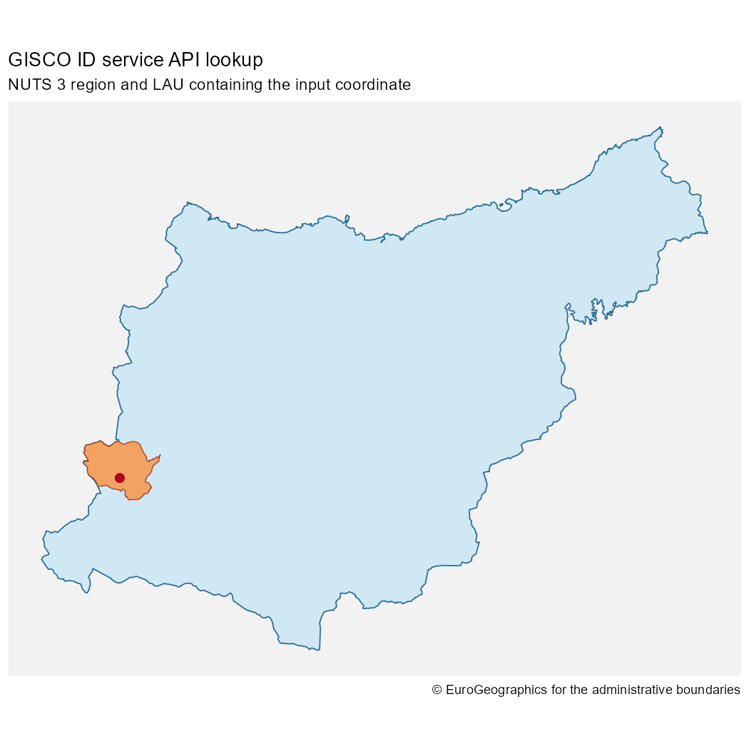
NUTS 3 and LAU geometries returned by the GISCO ID service API
You can also query NUTS regions by ID. The service supports identifier lookups for other datasets and Geonames name searches, but these lookup modes are not exposed by the corresponding giscoR functions:
gisco_id_api_nuts(nuts_id = "ES21", nuts_level = 2)
#> Simple feature collection with 1 feature and 1 field
#> Geometry type: MULTIPOLYGON
#> Dimension:     XY
#> Bounding box:  xmin: -3.450329 ymin: 42.47236 xmax: -1.728903 ymax: 43.45712
#> Geodetic CRS:  WGS 84
#> # A tibble: 1 × 2
#>   nuts_id                                                                    geometry
#> * <chr>                                                            <MULTIPOLYGON [°]>
#> 1 ES21    (((-1.998404 43.32102, -1.997205 43.32199, -1.997596 43.32216, -1.998184 4…
GISCO Address API
Use the GISCO Address API to geocode addresses, find addresses near a point and list available administrative address components.
province and city are generic terms whose administrative levels vary by country. Use the lookup helpers to inspect available address components:
gisco_address_api_countries()
#> # A tibble: 31 × 1
#>    L0
#>    <chr>
#>  1 AT
#>  2 BE
#>  3 BG
#>  4 CH
#>  5 CY
#>  6 CZ
#>  7 DE
#>  8 DK
#>  9 EE
#> 10 EL
#> # ℹ 21 more rows
gisco_address_api_provinces(country = "LU")
#> # A tibble: 12 × 1
#>    L1
#>    <chr>
#>  1 CAPELLEN
#>  2 CLERVAUX
#>  3 DIEKIRCH
#>  4 ECHTERNACH
#>  5 ESCH-SUR-ALZETTE
#>  6 GREVENMACHER
#>  7 LUXEMBOURG
#>  8 MERSCH
#>  9 REDANGE
#> 10 REMICH
#> 11 VIANDEN
#> 12 WILTZ
gisco_address_api_cities(country = "LU")
#> # A tibble: 542 × 1
#>    L2
#>    <chr>
#>  1 ABWEILER
#>  2 AHN
#>  3 ALLERBORN
#>  4 ALSCHEID
#>  5 ALTLINSTER
#>  6 ALTRIER
#>  7 ALTWIES
#>  8 ALZINGEN
#>  9 ANGELSBERG
#> 10 ANSEMBOURG
#> # ℹ 532 more rows
gisco_address_api_roads(country = "LU", province = "Capellen", city = "Dippach")
#> # A tibble: 16 × 2
#>    TF                      PC
#>    <chr>                   <chr>
#>  1 BEIM WAASSERTUERM       4972
#>  2 ECKERBIERG              4974
#>  3 IM INBERG               4974
#>  4 OP WAISSE MUOR          4974
#>  5 ROUTE DE LUXEMBOURG     4972
#>  6 ROUTE DE LUXEMBOURG     4973
#>  7 ROUTE DES TROIS CANTONS 4972
#>  8 RUE BELLE-VUE           4974
#>  9 RUE CENTRALE            4974
#> 10 RUE DE BETTANGE         4974
#> 11 RUE DE HOLZEM           4974
#> 12 RUE DE LA FONTAINE      4974
#> 13 RUE DES ROMAINS         4974
#> 14 RUE DU CIMETIÈRE        4974
#> 15 RUE JEAN-PIERRE KIRSCH  4974
#> 16 SAUER AARBECHT          4974
Use gisco_address_api_search() for structured or freeform geocoding. Structured searches can match approximate spellings. Searches return at most 1,000 addresses. Use gisco_address_api_bbox() to get a bounding box for the returned address points.
Freeform queries use the q argument to search for an address in a single string and do not support approximate string matching. Autocomplete through /search?suggest= is not implemented in giscoR.
freeform <- gisco_address_api_search(q = "alphonse weicker luxembourg")
address <- gisco_address_api_search(
  country = "LU",
  city = "Luxembourg",
  road = "Rue Alphonse Weicker"
)

bbox <- gisco_address_api_bbox(
  country = "LU",
  city = "Luxembourg"
)
Use gisco_address_api_most_populated_cell(city = "Madrid") to retrieve the most populated census grid cell. Supply province, city or both. When you supply both, the function searches within the city in the specified province. When a cell is found, the function returns a one-row tibble with the API coordinates in numeric X and Y columns. The API documentation does not specify the CRS for these coordinates, so the function preserves them without creating a geometry.
Search and reverse geocoding return sf objects when coordinates are available. Queries with no address results return an empty tibble. gisco_address_api_bbox() returns an sf object when it finds a bounding box and NULL otherwise. Pass the coordinates from a search result to gisco_address_api_reverse() to retrieve up to five nearby addresses.
gisco_address_api_reverse(
  x = address$X[1],
  y = address$Y[1],
  country = "LU"
)
#> Simple feature collection with 5 features and 14 fields
#> Geometry type: POINT
#> Dimension:     XY
#> Bounding box:  xmin: 6.16786 ymin: 49.6315 xmax: 6.169307 ymax: 49.63328
#> Geodetic CRS:  WGS 84
#> # A tibble: 5 × 15
#>   LD    TF    L2    L1    L0    I3    PC    N0    N1    N2    N3    OL        X     Y
#> * <chr> <chr> <chr> <chr> <chr> <chr> <chr> <chr> <chr> <chr> <chr> <chr> <dbl> <dbl>
#> 1 4     RUE … LUXE… LUXE… LU    LUX   2721  LU    LU0   LU00  LU000 8FX8…  6.17  49.6
#> 2 3     RUE … LUXE… LUXE… LU    LUX   2180  LU    LU0   LU00  LU000 8FX8…  6.17  49.6
#> 3 41B   AVEN… LUXE… LUXE… LU    LUX   1855  LU    LU0   LU00  LU000 8FX8…  6.17  49.6
#> 4 2     RUE … LUXE… LUXE… LU    LUX   2180  LU    LU0   LU00  LU000 8FX8…  6.17  49.6
#> 5 5     RUE … LUXE… LUXE… LU    LUX   2721  LU    LU0   LU00  LU000 8FX8…  6.17  49.6
#> # ℹ 1 more variable: geometry <POINT [°]>
Use the returned geometries directly with ggplot2:
ggplot(bbox) +
  geom_sf(fill = "#f1faee", color = "#457b9d", linewidth = 0.5) +
  geom_sf(data = address, color = "#d00000", size = 2) +
  coord_sf() +
  theme_minimal() +
  theme(
    panel.background = element_rect(fill = "grey95", color = NA),
    axis.line = element_blank(),
    axis.text = element_blank(),
    panel.grid = element_blank()
  ) +
  labs(
    title = "GISCO Address API lookup",
    subtitle = "Address search results inside the Luxembourg city bounding box",
    caption = gisco_attributions()
  )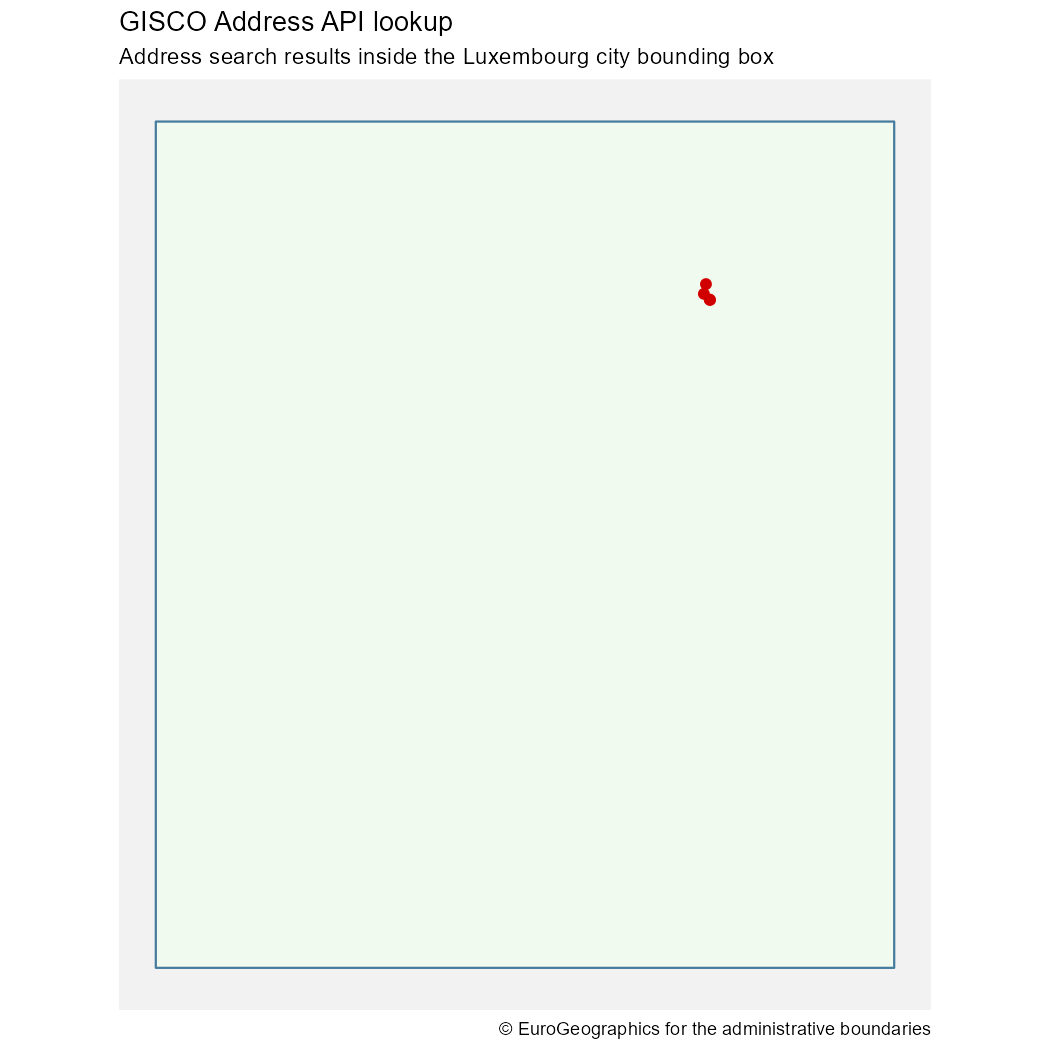
Structured address search result and city bounding box
Choosing between APIs and downloads
Use download functions when you need complete datasets:
countries <- gisco_get_countries(year = 2024)
nuts <- gisco_get_nuts(year = 2024, nuts_level = 2)
Use API functions when you need targeted answers:
- Which NUTS region contains this coordinate?
- Which LAU contains this coordinate?
- What address is closest to this coordinate?
- Which address components are available for a country, province or city?
For repeated spatial analysis over many records, downloading a full dataset and joining locally is often more robust than making one API request per row. API requests are best suited to interactive lookup, validation and small batches.
Defensive use
In scripts, check for NULL before using the result of an API call.
res <- gisco_id_api_country(x = x, y = y)

if (is.null(res)) {
  message("The GISCO ID service API did not return a result.")
} else {
  res
}
For address searches, also check for an empty result before accessing rows.
In packages or tests, skip API-dependent checks when GISCO is not reachable. For reproducible workflows, keep API calls close to the point where the result is needed and avoid assuming that live services will always return exactly the same number of rows.